See it in action
Pro features,
out in the wild
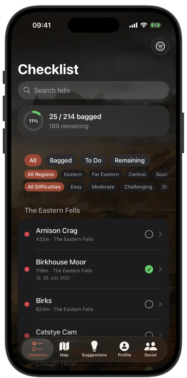
Your fell checklist
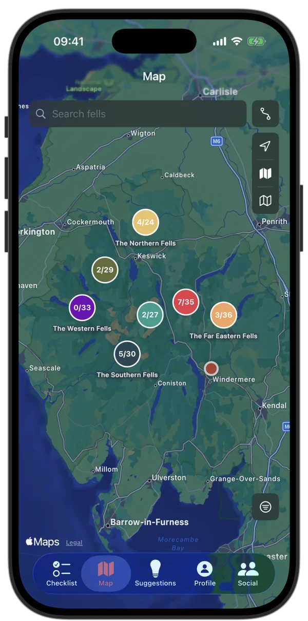
Lake District overview
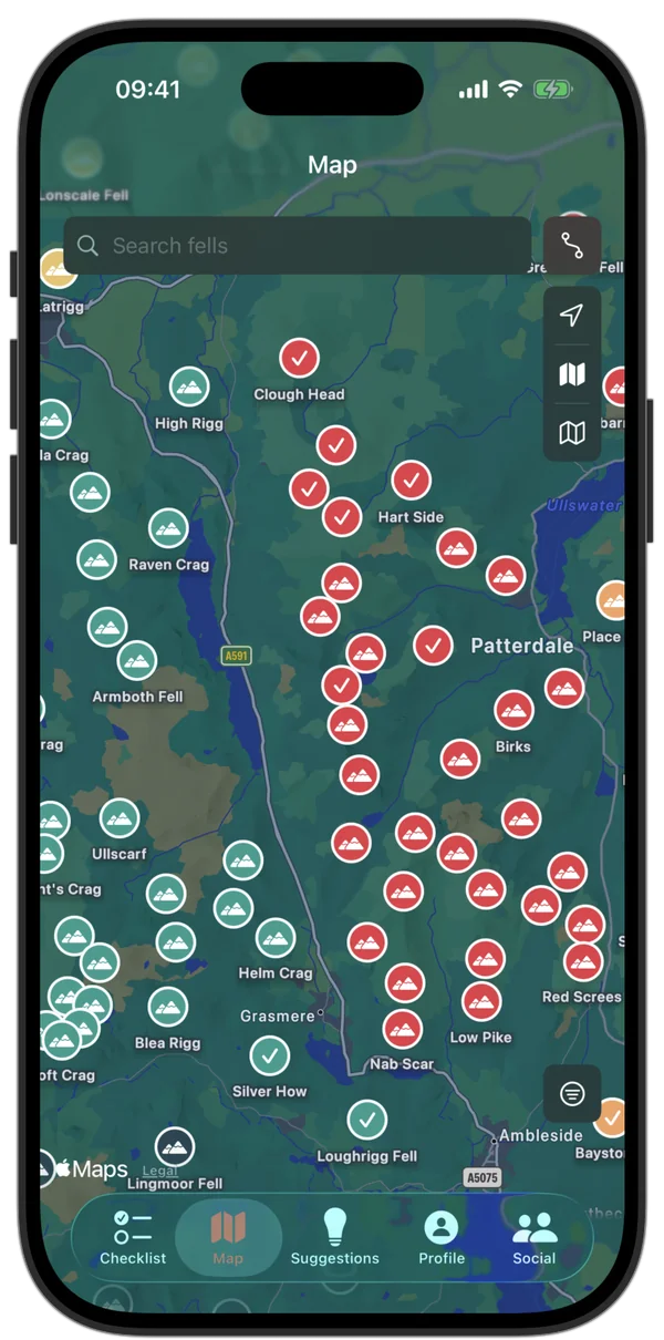
Fell pins at a glance
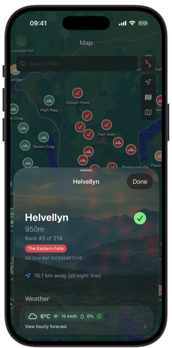
Every fell, in detail
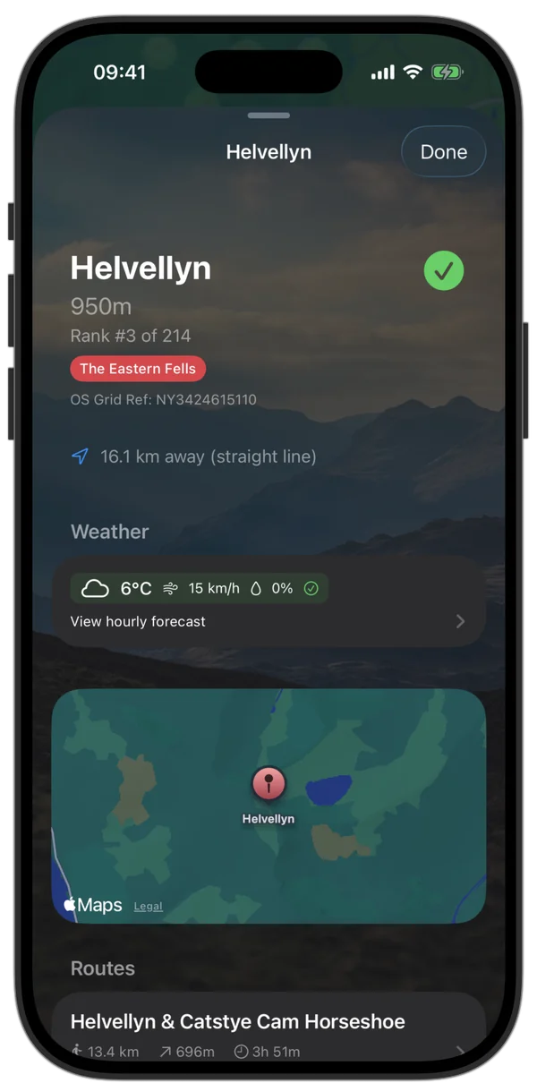
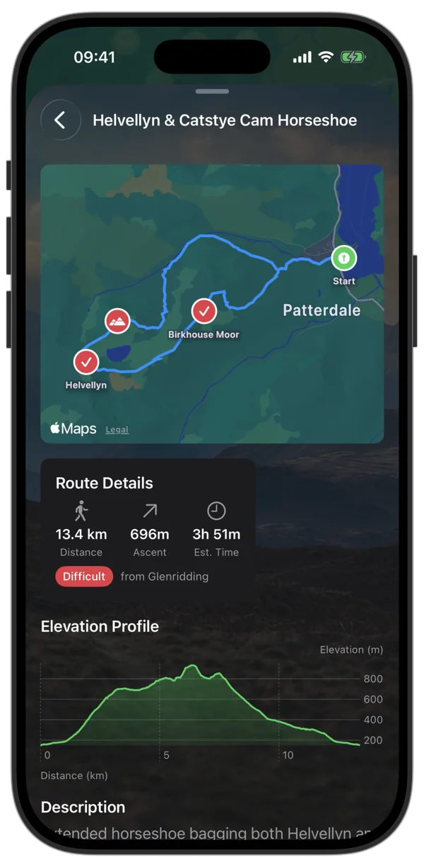
Routes and nearby fells
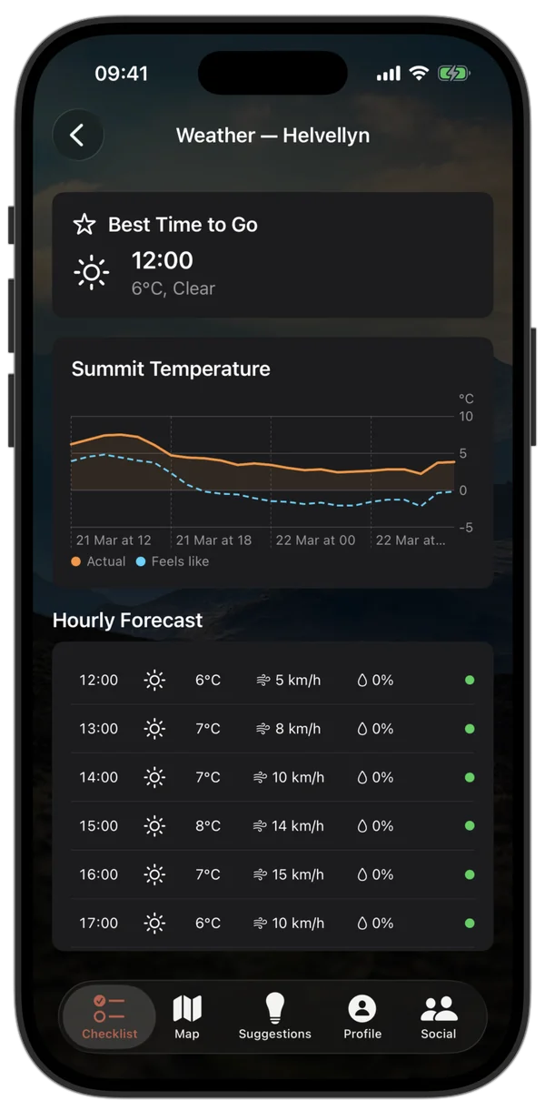
Summit weather forecast
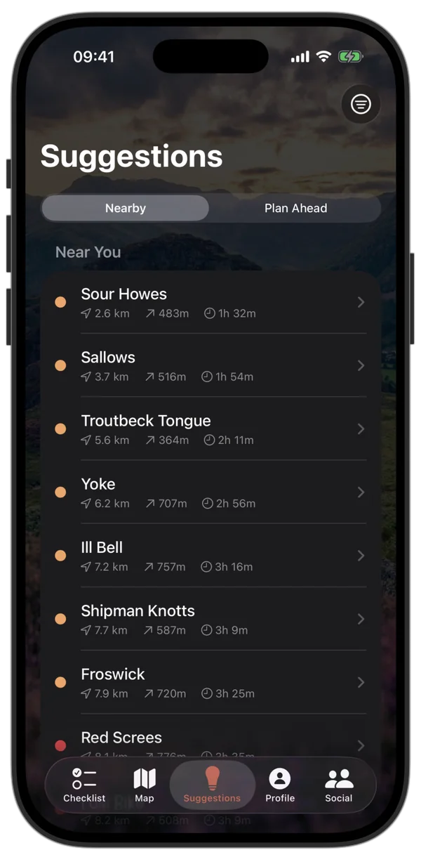
Smart suggestions
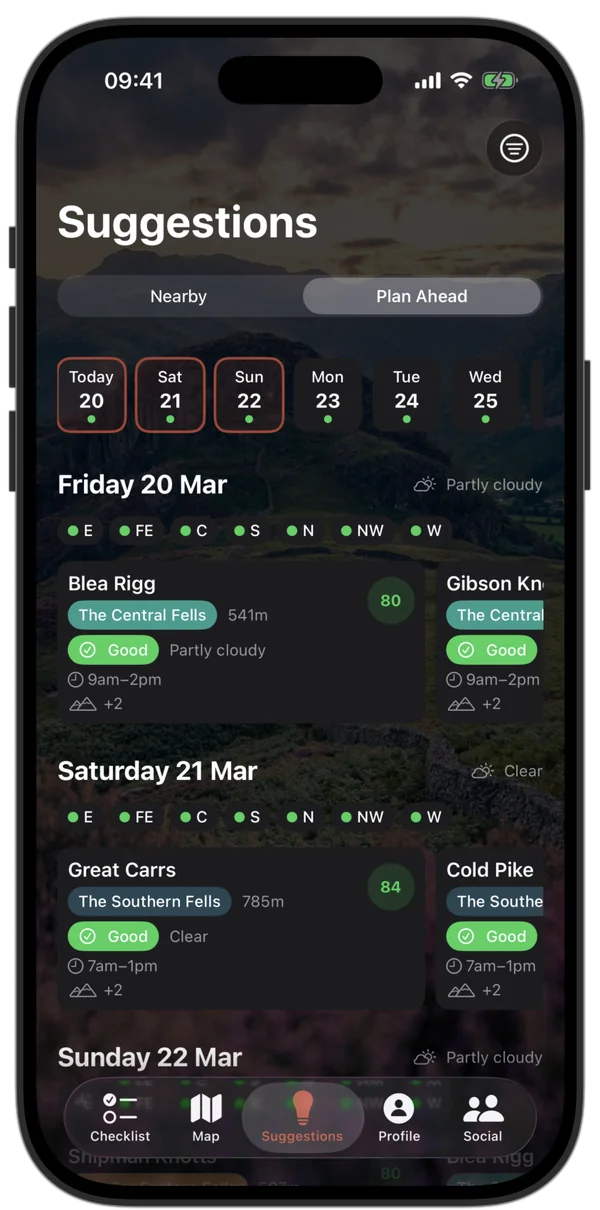
Plan your trip
GPS navigation
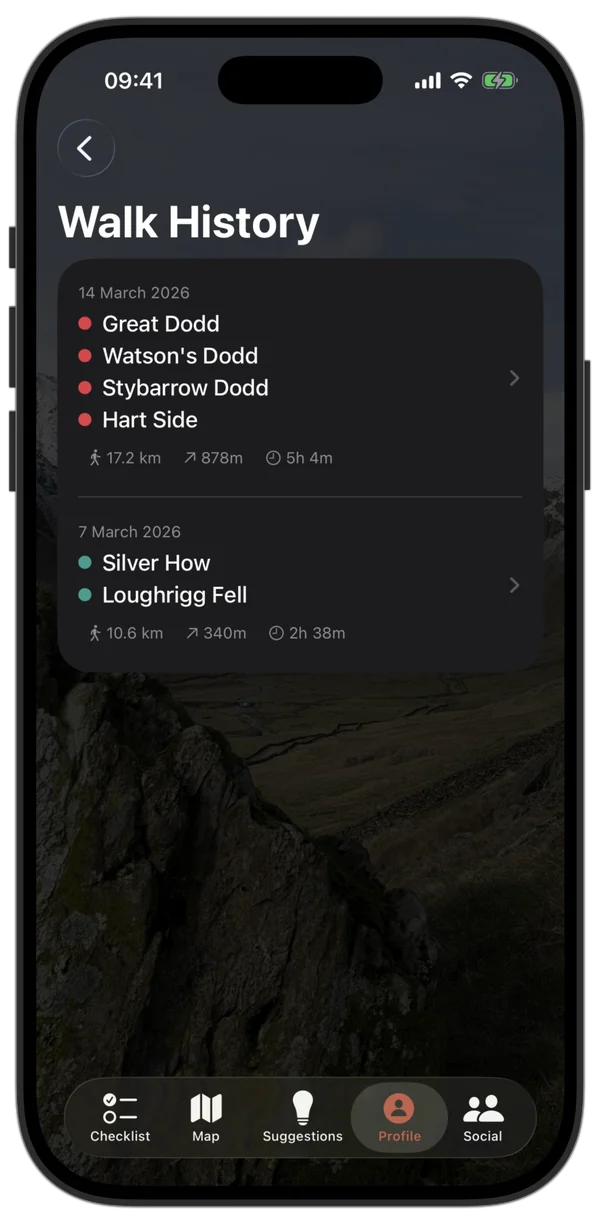
Track your activities
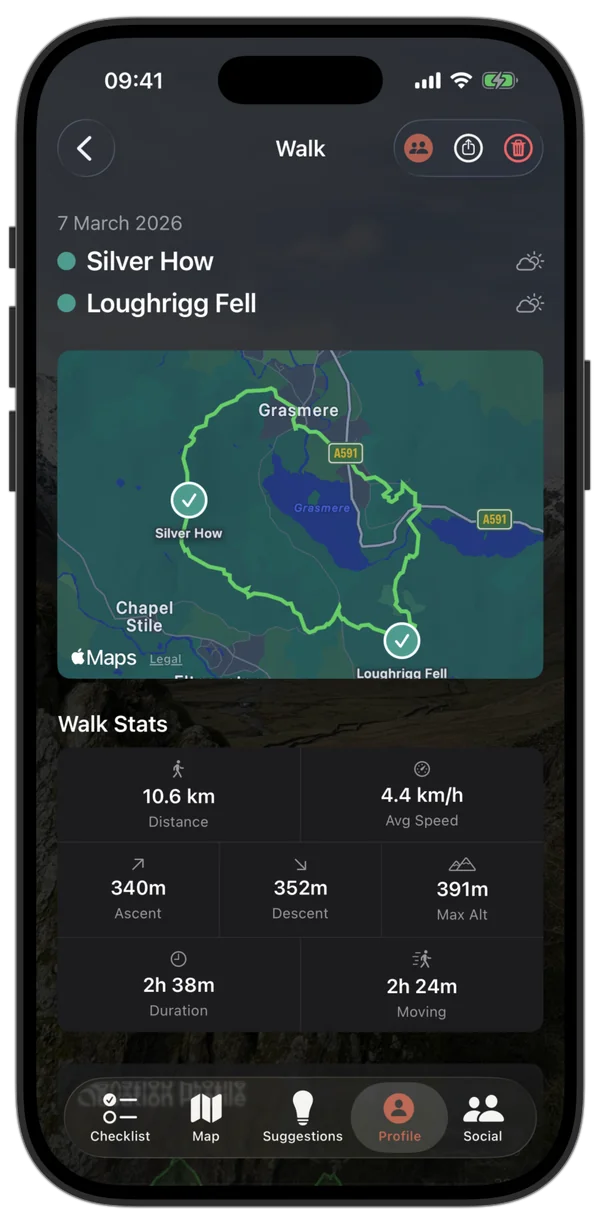
Walk recap
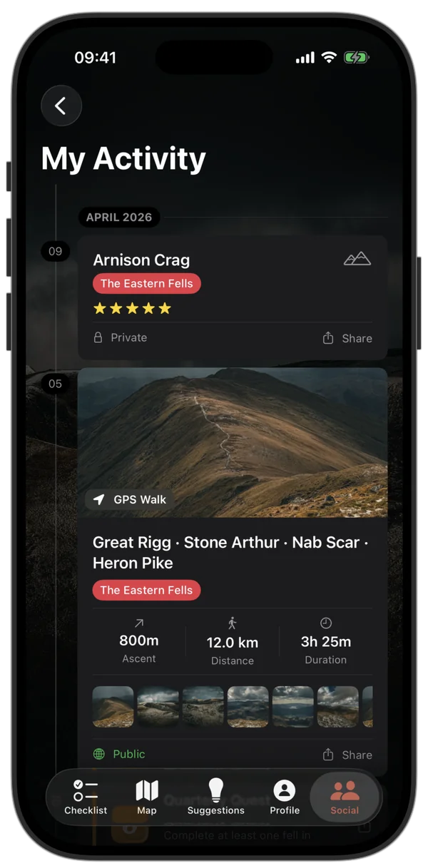
Activity timeline
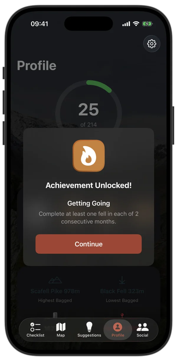
Achievements unlocked
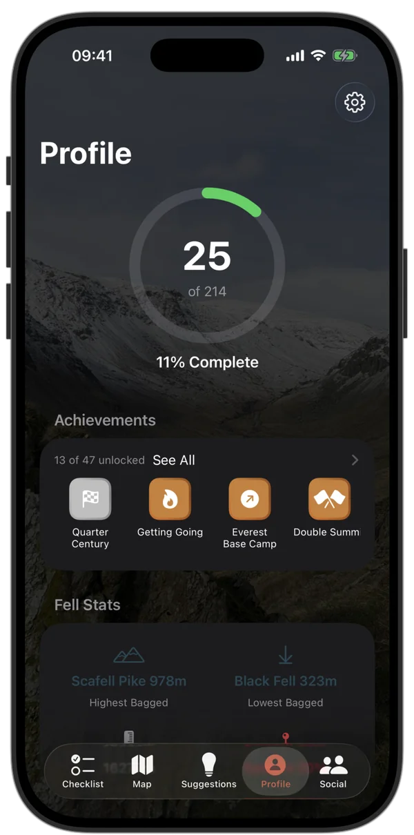
Your progress